California’s Fiery Wake-up Call from Climate

On the front lines of California wildfire Photo: Kari Greer, US Forest Service
From Washington Post Opinion:
We won’t stop California’s wildfires if we don’t talk about climate change
“CALIFORNIA, THE nation’s most populous state and the world’s fifth-largest economy , is on fire. In a state already known for monster conflagrations, the past month has been unusually destructive. The Mendocino Complex fire north of San Francisco is now officially the largest in California’s history, having burned an area about the size of Los Angeles, and it is just one of the major blazes the state has had to face since last October.
…
As much as the president might prefer to point fingers elsewhere, it is impossible to talk about California’s blazes without considering the role of climate change. Four of the five largest conflagrations the state has had to battle have come since 2012 , according to the Los Angeles Times, and that is probably no mere coincidence. Droughts, storms and heat waves have occurred throughout history, of course, and it is hard to attribute any single event to climate change. But scientists have concluded that climate change has increased the frequency of extreme weather and will continue to do so.”
Find the full Post opinion piece HERE.
From the NASA website:
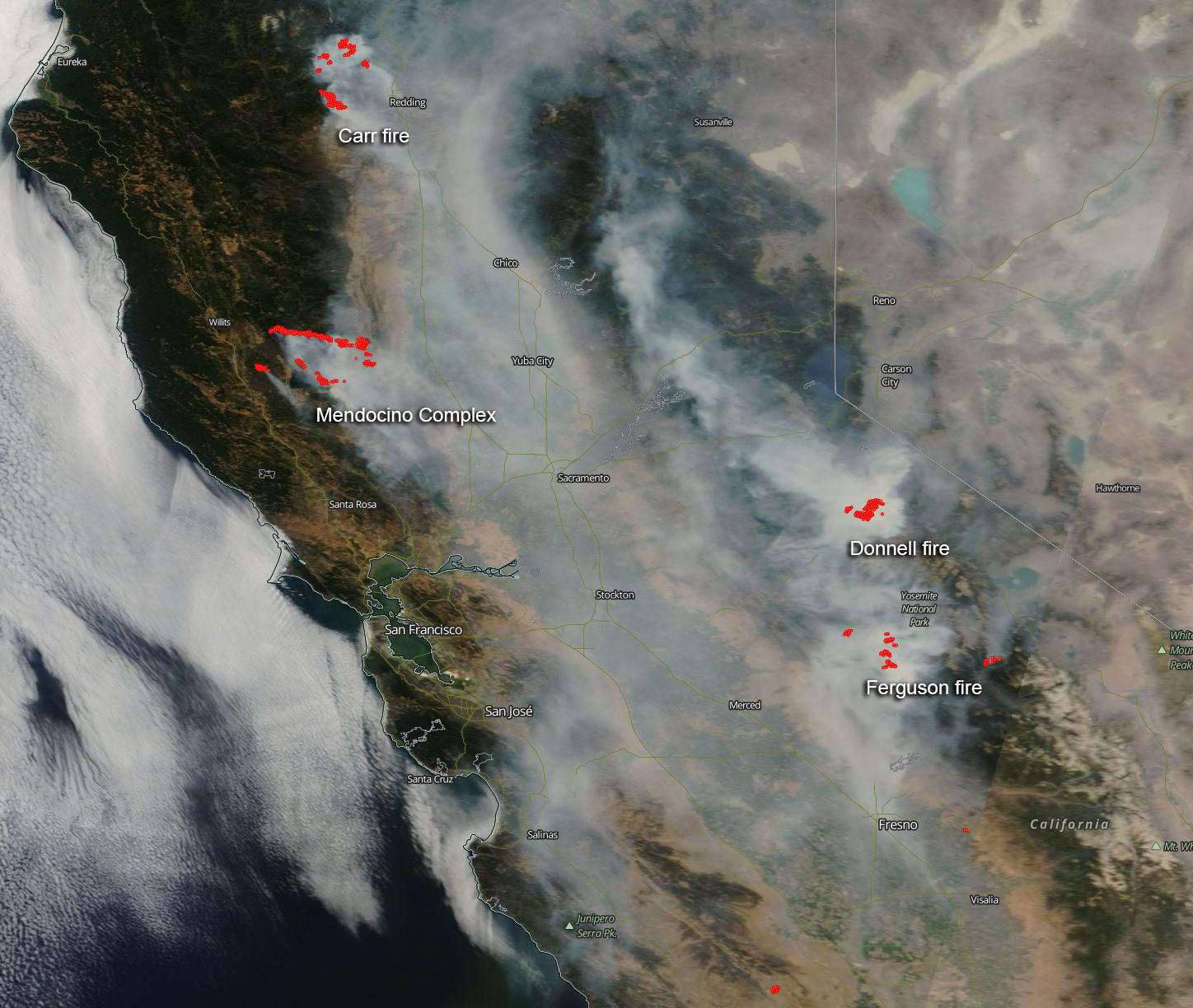
“Across the entire state is a blanket of smoke. The air quality in much of California is moderate to hazardous depending on proximity to the fires, however, there are very few areas in the entire state that are not being affected by the smoke coming off the fires throughout the state. The EPA’s AirNow website gives a roundup of the air quality indexes for the state here: https://www.airnow.gov/index.cfm?action=airnow.local_state&stateid=5 The smoke released by any type of fire (forest, brush, crop, structure, tires, waste or wood burning) is a mixture of particles and chemicals produced by incomplete burning of carbon-containing materials. All smoke contains carbon monoxide, carbon dioxide and particulate matter or soot and is hazardous to breathe.”
“NASA’s Aqua satellite captured this image of the fires and smoke blowing from them on August 06, 2018 with the Moderate Resolution Imaging Spectroradiometer, MODIS. Actively burning areas (hot spots), detected by MODIS’s thermal bands, are outlined in red.”